
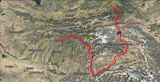
After 5 days in Osh it was time to move on again, I would leave Osh and travel south into Tajikistan and follow the famous Pamir Highway south and then east along the Afghanistan Border to Tajikistan’s Capital Dushanbe.
Osh was a nice small town to spend some time and rest but also I needed to do some more bike maintenance, the new chain and sprockets which I put on in Mongolia were heavily worn and I didn’t trust them to make it through to Dushanbe as there would be no spare parts where I would be going. All through Mongolia, Kazakhstan and Kyrgyzstan I had cleaned and oiled the chain sometime twice a day and yet it was continuing to stretch out of control, it was disappointing that it has only lasted around 8,000 kilometres when it should have been good for around 20,000 kilometres.
In Osh I stayed at the Tes Guesthouse which is a favourite for Overland travellers, cars, Motorcycles and cyclists, it was clean and had secure parking, small Dorm Rooms, Gers and tent space in the garden.


Leafy Osh Street.

Museum with Sulayman-Too in the background.

Local outdoor Restaurant which served great food and no insects, I mean bothering you while you were eating not that you eat insects……..

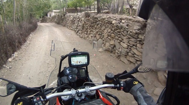
At the Guesthouse I met a great German couple Till and Lin riding a Honda Africa Twin so Till and I paid a visit to the local Motorcycle Hire/Repair shop MuzzToo to sort out some things with our bikes before we all head south. An English guy George was running the place and he was very helpful, even though they hire a repair mostly Yamahas they had a spares box with bits and pieces of BMW spares in it so I managed to find a chain and two sprockets which would fit. George also let us use some of the tools we didn’t have and within a few hours I had two new sprockets and a near new chain fitted and all for around $60 for the parts, I shouldn’t need another chain and sprockets again hopefully.

We all went out for Dinner on the Friday night with an Italian guy who had just arrived and had a massive plate of Shasliks and some Beers. Till and Lin left for the Pamir on Saturday but I stayed for an extra two days because my stomach was still doing somersaults from a dodgy Shaslik.
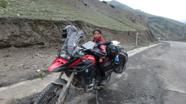
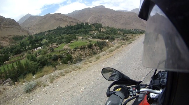
On Monday morning I was feeling much better and could afford to leave the toilet behind so I packed up and headed out of Osh towards the Tajik Border at around 9.00 a.m. and it was over 30 degrees already. As I got closer to the Border the road started to climb and within minutes the temperature had dropped 15 degrees and some light rain had started. I had stopped to put on some extra layers and have a snack and this girl ran all the way down the hill from her house to say Hello, this is normal here.

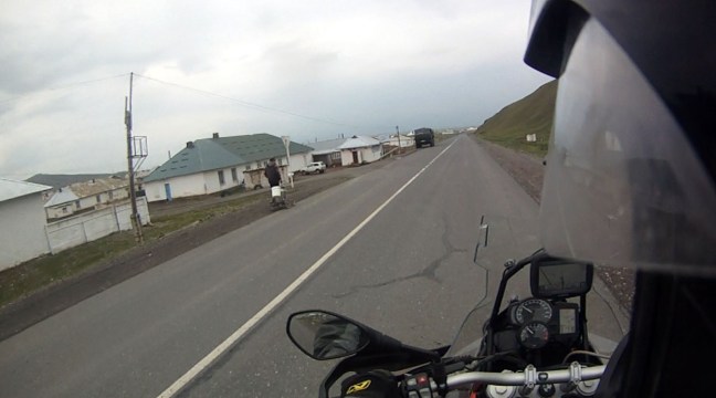
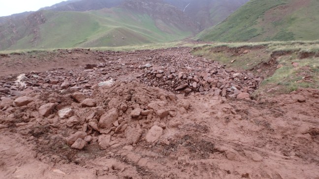
I continued climbing over the passes with the odd small Landslide and in no time I arrived at the small, cold and bleak Village of Sary Tash where I filled up and used the last of my Kyrg cash.
Not far south of here the Pamirskiy Trakt or Pamir Highway (M41) would officially start although the overall route actually starts in Osh.
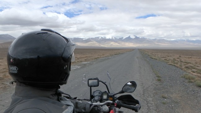
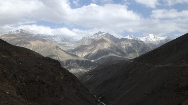
The Pamir Highway traverses the Pamir Mountains through the Gorno- Badakhshan Autonomous Region in Tajikistan, it was partly built in the 19th Century and then upgraded by the Russians in the 1930’s but has formed part of the Silk Road for thousands of years. A large proportion of the road is around 4000 metres above Sea Level with the highest point at the Ak-Baital Pass at 4661 Metres and Altitude Sickness can be common with travellers more so those who travel from the east to west as it climbs steeply. The Highway is the second highest road in the world behind the nearby Karakoram Highway, this and the Wakan Valley bordering on Afghanistan was on the top of my list when planning this trip.
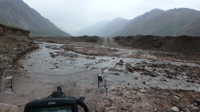
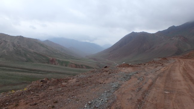
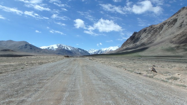
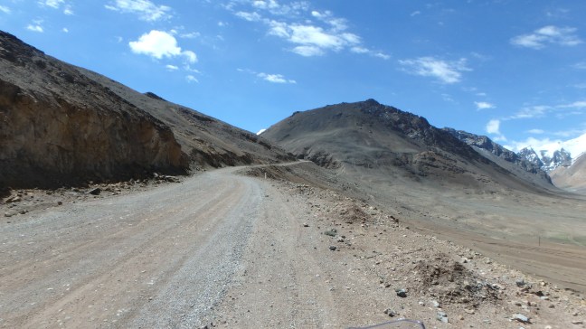
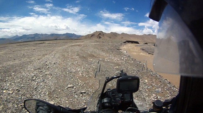
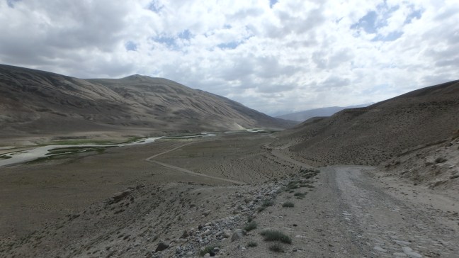
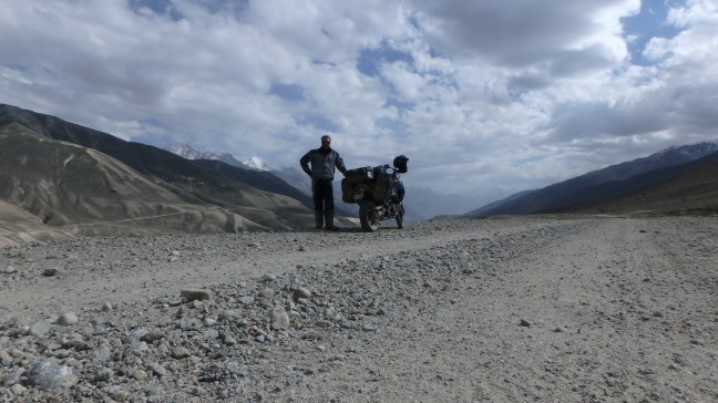
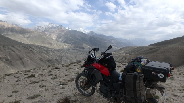
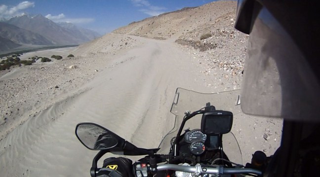
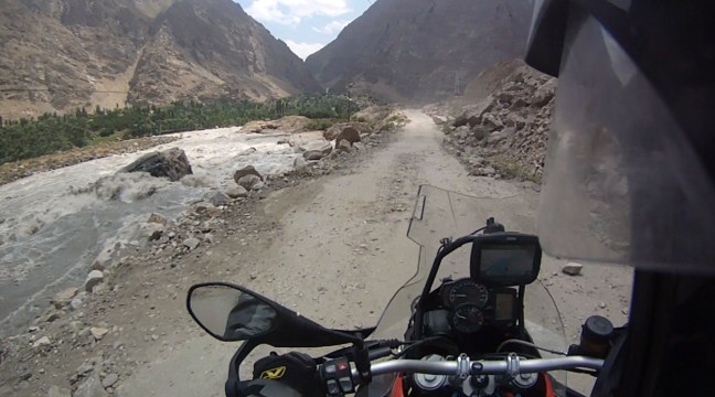
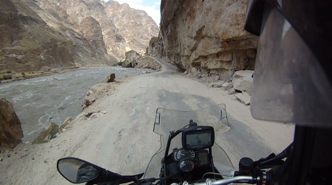
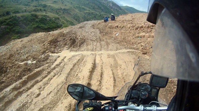
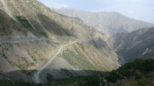
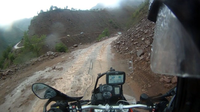
Approaching the Pamir Mountains from Kyrgyzstan as the road conditions and the weather worsen.


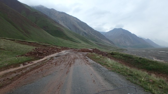
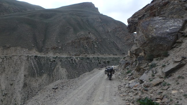
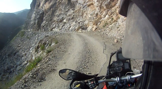
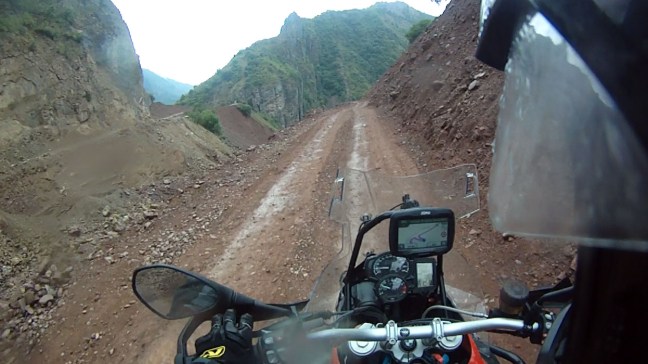
There is a road in there…trust me.
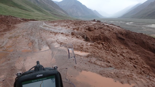
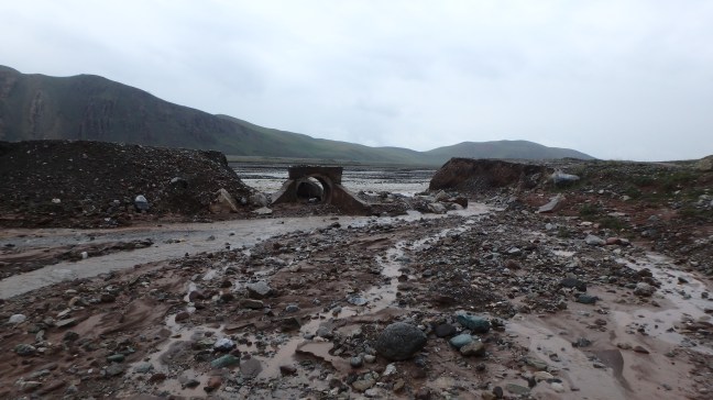
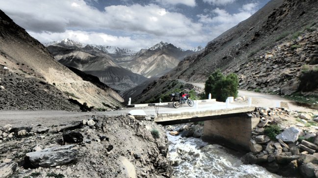
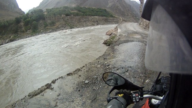
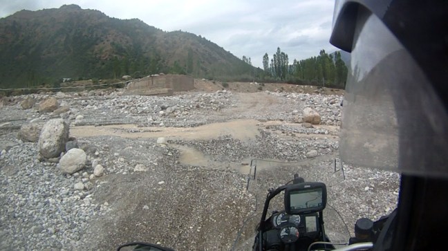
The Bridge is out….again….
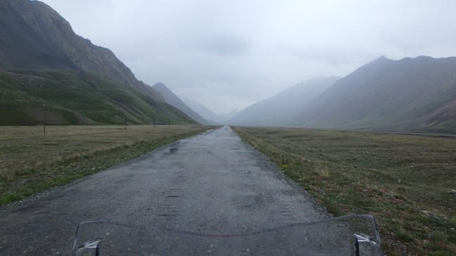
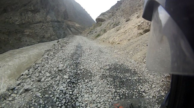
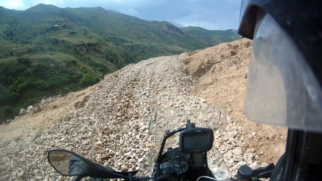
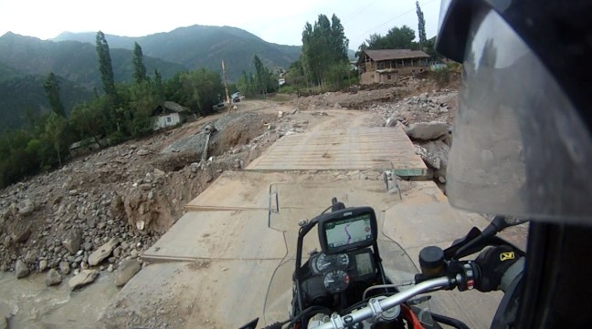
A little bit of decent road which didn’t last long.
I arrived at the Kyrgyzstan Border Crossing in the rain and was the only one there. The guards initially got excited about an issue with my vehicle import and were obviously looking for cash to make the problem go away but it turned out when I crossed from Mongolia to Russia they put the incorrect date on the form then crossed it out and changed it. Once they realised that all the other dates matched they had no real reason to look for a bribe so I was free to go……
After playing fetch with the 2 Guards dogs for 15 minutes the Immigration Officer turned up from lunch and opened the gate to 20 Kilometres of No Mans Land between Kyrgyzstan and Tajikistan and I was off into the rain.
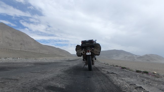
Not far from the Border Crossing the road rose sharply with a series of switchbacks which I would need to get used to.
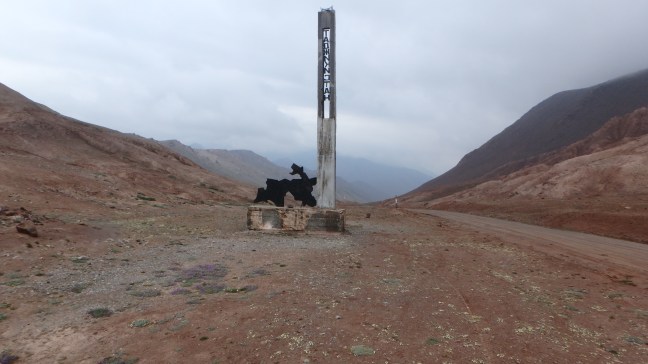
The Pass in No Mans Land at just over 4000 Metres, it was a little cool.

I finally reached the Tajik Border Post which is a desolate place on top of a Mountain Pass but the Guards were very friendly one even bringing me a Drink and Water Melon while I waited for the Customs Officer to return. He also had a part time job as the local Money Changer so I changed $50 US and got an OK rate, at least I had local cash if I found Fuel or anything looking like a shop. After around 20 minutes I was through and in Tajikistan.
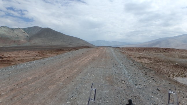
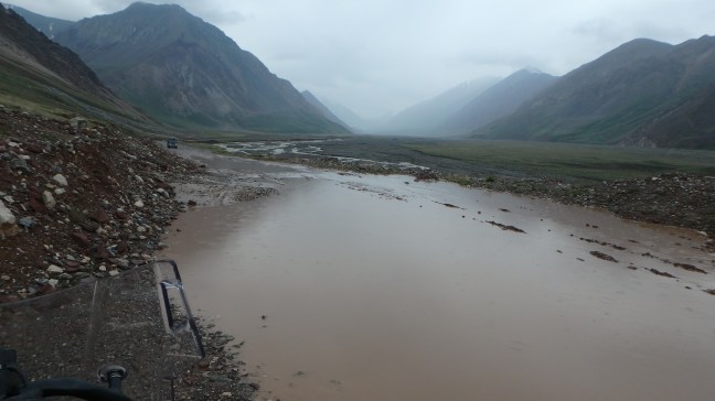
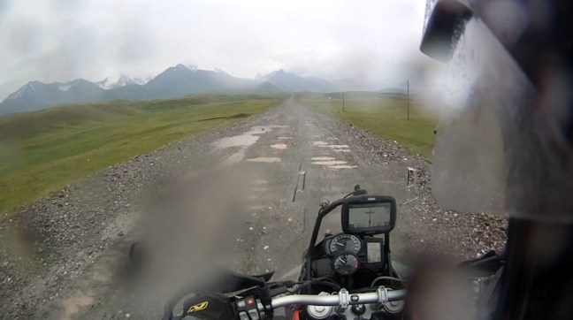
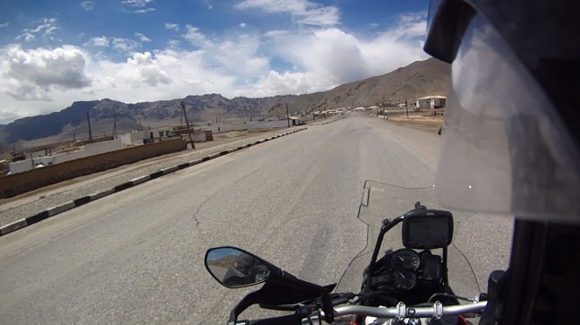
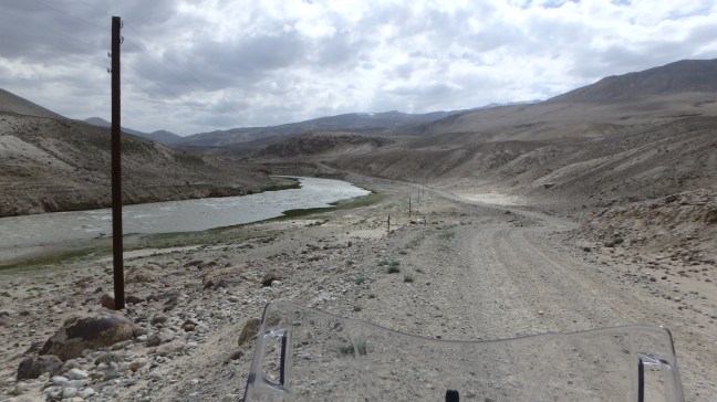
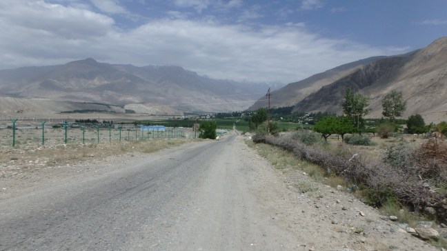
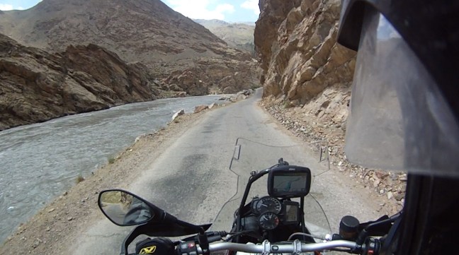
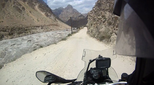
Some sections of the road were Bitumen but it was soft and in some places stuck to my tyres as I rode across it, I would later find this was a good quality road for Tajikistan standards.
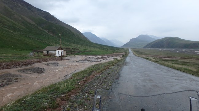
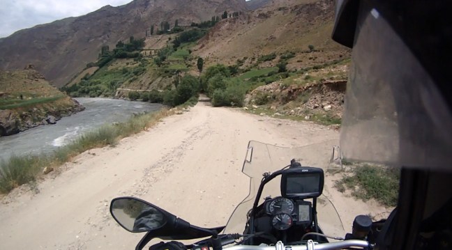
South of the Border I arrived at Kara-Kul or Kara Lake where I started looking for a place out of the wind to camp, this wasn’t easy as the area around the Lake was flat and getting buffeted by the wind in all directions and the temperature had dropped to 6 degrees.

I rode past the Lake and found a place out of the wind off the side of the road, I had not seen anyone since entering Tajikistan so I think camping will be very quiet and peaceful.
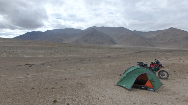

This camp was at 4200 Metres but other than a minor head ache that night I had no symptoms of Altitude Sickness so hopefully I would be lucky for the rest of the Highway. So after a quick breakfast I was on my way again and the weather had improved.
Back to work……well someone has to do the hard yards…..
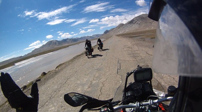
Talking about hard yards, I don’t know how the Cyclists do it but this route is one of the most popular for Cyclists in the world.
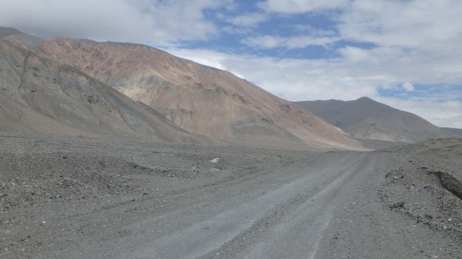
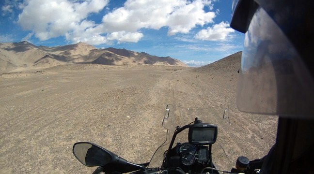
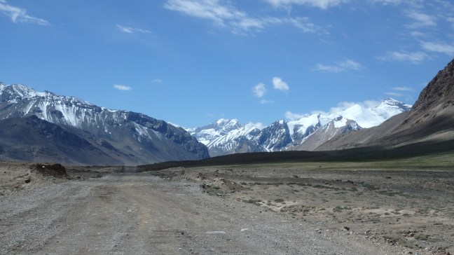
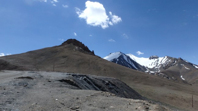
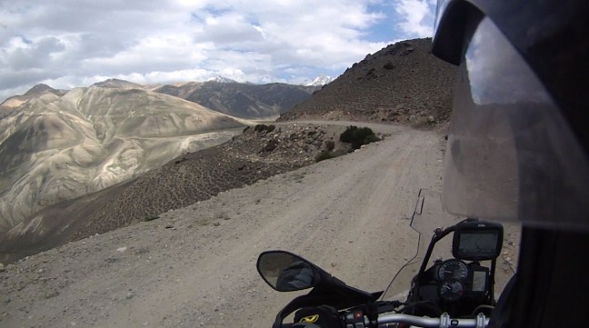
Then I started the slight climb up to Ak-Baital Pass which was stunning.
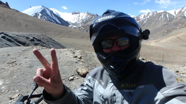
At the top of the Pass, 4660 Metres above Sea Level, the highest I have ever been, another first.

Yet another bridge that just got up and ran away….
And this one just before Murghab where the workers were very concerned I wouldn’t get through but yet again the bike just ploughed on through no problems.

Further along the road I arrived at Murghab which is a moderate sized town for Tajikistan and filled up with the best fuel from a drum I’ve ever had, well the only fuel from a drum I’ve every had….

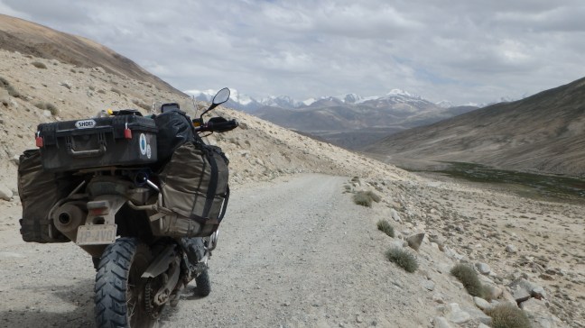
South of Murghab I took the dirt turn off towards the Wakan Valley.

My first view of Afghanistan’s Hindu Kush Mountains on the other side of the Wakan Valley.
And the small Border outpost between Tajikistan and Afghanistan, all of these borders are closed and heavily guarded as you would expect.
After going through a small Military Check Point where I don’t think they have seen many tourists and even fewer Motorcycles the road descended down the Valley and ran alongside the Pamir River.
Small Adobe Huts on the Afghan Side of the River.

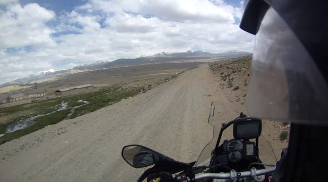
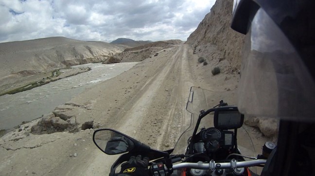
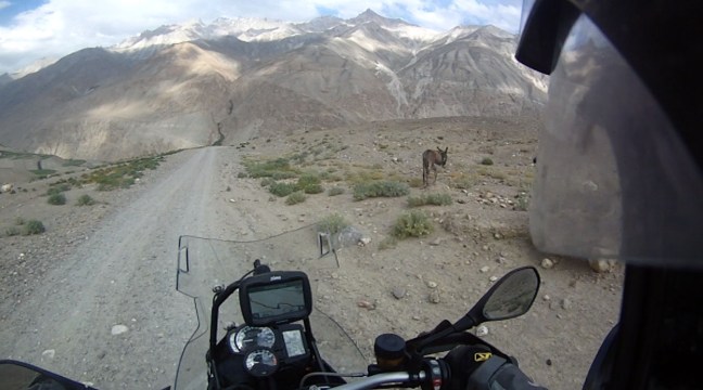
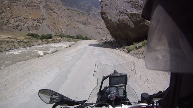
The eastern end of the Valley is very remote and doesn’t get many travellers as they mostly stay on the Pamir Highway (M41) which runs to the north. Sometimes the road is sandy and some areas it falls away and is not repaired so it can be slow going but the views are nothing short of spectacular.


The first Village you come to is Langar where the road zigzags down from the top of a steep Mountain and you find yourself in lush green fields and a very pretty treed Village where everyone waves to you as you go past.
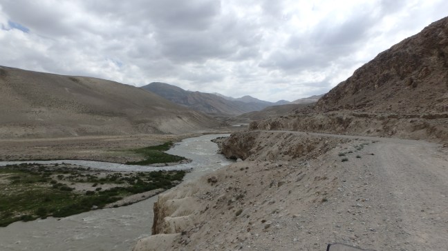
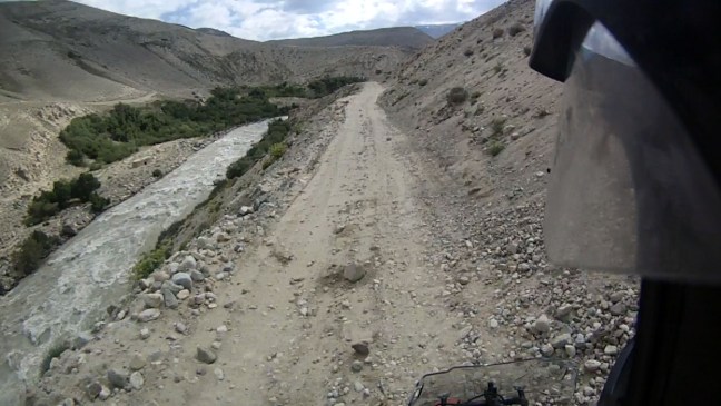
On the other side of the village the road runs along the sandy River Bank for a little while and gets a little tricky with a heavy bike, the Pamir River also merges with another smaller River here and becomes the Panj River.
It was getting late and had been a long day so I started looking for a campsite which wasn’t easy to find with the steep cliffs on one side and the river on the other and the only green areas were in the Villages. I eventually found a spot behind some trees on the side of the road, not ideal but the wind had whipped up and it looked like a storm was on the way.

The wind was heavy all through the night and coated everything with a layer of sand and the following morning it was a quick pack up and back on the road.
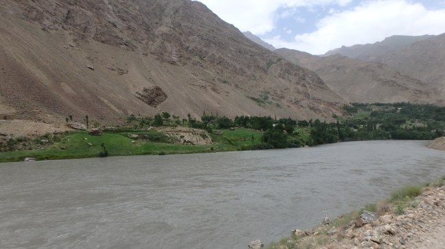
There were numerous green Villages on both sides of the River, they obviously don’t have a water shortage….
A great example of a Vertical Garden….
Tajik Miliaty Patrol, Patrols and Check Points are scattered all along the route.

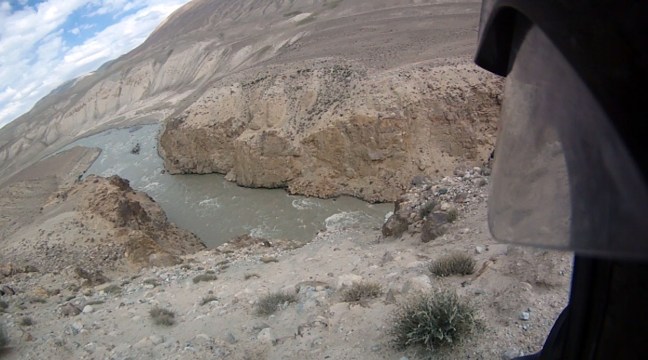
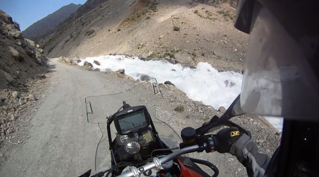
In some areas the Panj River seems very angry and I would hate to fall in as the current moves faster than I’ve seen in any other River, not a place for Kayaking.
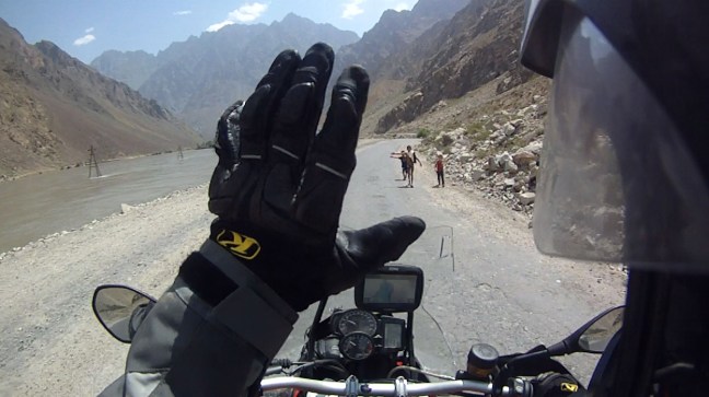
All along the route but mainly in or near the Villages the local Kids get very excited to see tourists in their Village particularly on Motorcycles, many run from their houses to the side of the road to wave. A lot however want to High Five you as you go past which gets very dangerous as they can just appear from nowhere and get very close to the Bike. It would be very easy to hit them so I would give them a wide berth and a wave instead, maybe they are disappointed but at least we all avoid an accident.
The Afghan Border Crossing at Ishkashim where they sometimes open the Border to hold a Market where Tajik’s and Afghan’s along with tourists can buy and sell goods, this was normally held every Saturday but has been less frequent recently.

All the locals are very friendly and helpful even if they initially look at you like you have just landed from Mars. These guys spoke very good English and were really happy to get some ‘Selfies’ with the bike.

I reached the large town of Khorugh mid afternoon and it was hot so I decided to have a short and easy day so I found the Pamir Lodge on my GPS and negotiated numerous small laneways and footpaths to get there before I melted. It was a great place to stop mid week and have a shower and a rest and there are plenty of places to get decent meals. Khorugh is also the junction where the main Pamir Highway meets the Wakan Valley Road (E 009) and it appeared that the road was bitumen from here to Dushanbe, which wasn’t actually correct as you will see.
So after a peaceful night at the Lodge I rode out of the chaos of downtown Khorugh north towards Dushanbe. It was a long run and I didn’t expect to make it all the way but I also didn’t expect the road to be in such bad condition with large chunks of Bitumen missing, numerous Landslides and deep pot holes all over the place. Other than locals putting grass and sand in the Pot Holes I don’t think it has had any real maintenance since the collapse of the USSR in the 1980’s so it made for a very slow and rough trip.
Cleared Landslide….Thank you..

Another closed Border Bridge with Afghanistan, maybe one day things will be different and these borders will be like any other in the Region.

This section of the Pamir Highway had numerous Semi Trailers and other larger trucks that needed to be negotiated carefully, this one had broken down in the middle of the road on a hill.

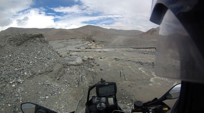
This section had River water flooding over the track.
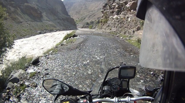
And this was like riding on a River Bed….
A nice scenic Waterfall……
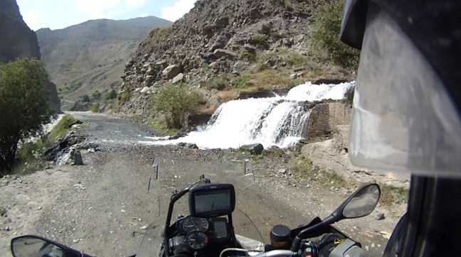
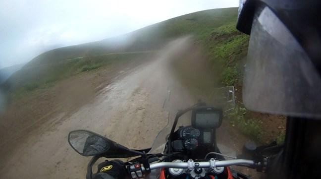
Which turned the road into a Creek…..
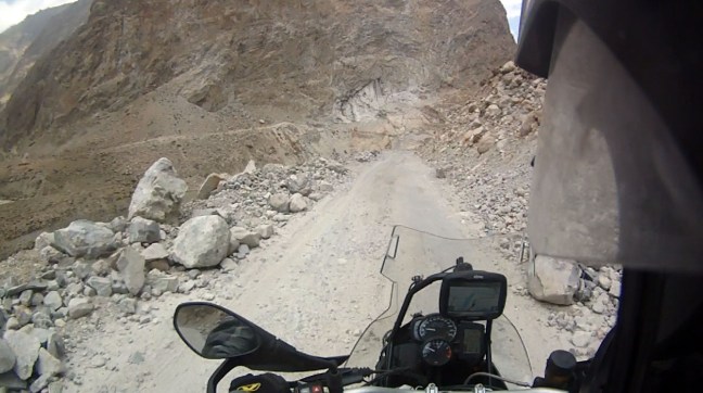
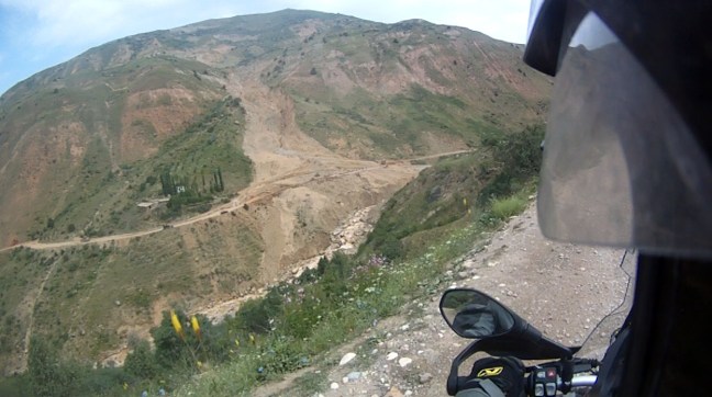
I had heard from other travellers about a massive Landslide which had closed the road the day before but the road had been reopened. As I rode around a Mountain side I could clearly see that I had found it.
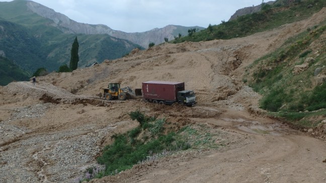
And I had also found a Truck stuck fast in the mud at the bottom leaving no room for the bike to get around. After an hours wait an Excavator came along and pushed the Truck through leaving a muddy mess and large River Stones for me to negotiate without dropping the bike.
First some Mud….I bet these locals were hoping this Tourist dropped his expensive Bike in the Mud and they could have a good laugh….
Sorry to disappoint you fellas. After a bumpy ride I was through unscathed.
Not long after this I arrived at the town of Qalai Khumb where you come to a T intersection. Left is the Southern route to Dushanbe which is in better condition and right is the Northern Route or the original M41 which traverses high Mountain Passes and is of questionable condition. The choice was made for me as the Southern Route was blocked by a Landslide which wasn’t expected to be cleared for at least a week. So off towards the Mountains I rode dodging High Fiving Kids and Dogs that liked to chase Motorcycles.
After yet another Military Check Point the road started to climb rapidly again through numerous switch backs.
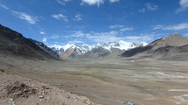
It was again getting late and the sun was dipping behind the Mountains so I started looking for another campsite. Again this proved difficult as the road was cut into the side of Mountains so there were no flat areas to pitch the tent until I got to the top of a pass and saw this……..perfect…


I set up camp with two German Cyclists who had also thought that this was a great place to camp. During the night the temperature dropped to below 5 degrees and the Rain started, this lasted all night and it was still raining when I packed up in the morning.
The road down the Mountain was characteristically slippery so the decent was slow and in either first or second gear with the occasional sliding rear wheel to keep me on my toes.
After a few hours riding through the Mountain Passes I came to a blocked road and a large number of cars and trucks parked, it didn’t look promising. It turned out that part of the road on the side of the Valley had caved into the River below and the excavators were busy trying cut a new one to get traffic moving again. As the Southern route was closed all of the traffic was using this road so there were cars lined up at the bottom of the Valley and also with me at the top of the Valley. Nothing left to do but wait.


While I was waiting I was invited to sit with a group of Truck Drivers who shared their massive watermelon with me and then I met the Engineer who was supervising the road repair. He couldn’t speak English but we managed to communicate really well the way Engineers and Architects have for thousands of years, by drawing pictures on rocks and stones. They were all very friendly and had the road ready to go in around 2.5 hours so not bad at all.
Once the new section of the ‘road’ was open it was like the start of a Grand Prix everyone wanted to be first…..

Some more Bridges which were away on Holidays….
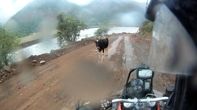
And a cow that just didn’t want to moooooove…..
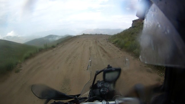
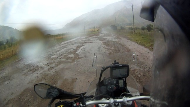
The road got ‘better’ as the rain fell..
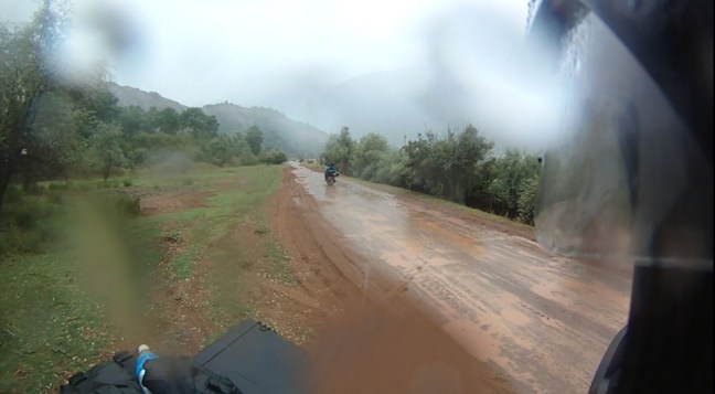
I had not seen any Motorcycle travellers the entire time I was on the Pamir and in the Wakan Valley but now I started to see them all coming the other way. Most Europeans travel this route from West to East it is mostly only Australians and a few Americans who start in the East, these two were from Western Russia and were in for a great day..

And these two (Girl and Guy) from Belgium on a Scooter with absolutely no Motorcycle gear, this was the only one left they started with two Scooters. I tried to be positive but other than a miracle they would never make it on that bike with around 50mm of ground clearance, I loved their optimism but I suggested finding a truck……
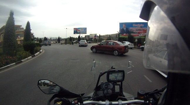
So eventually the rain cleared and some sort of bitumen road appeared for short periods and after a few hours I arrived at Dushanbe the Capital of Tajikistan five days after leaving Osh at the other end of the Pamir Highway.
The Pamir Highway and Mongolia were the primary reasons for this entire trip and the rest evolved from there. I have been pleasantly surprised by other areas such as Siberia and Kyrgyzstan but both Mongolia and the Pamir have not let me down and have both turned out to well exceed my expectations. Mongolia was the highlight up until now but the Pamir has just managed to outshine it by a small margin simply due to the stunning natural beauty and the tall Mountains and deep Valleys which Mongolia lacks. If anyone has an adventurous spirit and is looking for something like this don’t hesitate and do it now.
In the title of this post I described the Pamir as the best and worst road travelled, even though it has been the highlight of my trip so far the poor condition of the road can be frustrating and will smash both you and your bike no matter how you ride and for me the last two days dragged a little because of this. Even though the scenery is so spectacular that you will struggle to find the right words the consistent concentration needed is tiring and if I could turn back time I would have allowed 6 or 7 days which would be more ideal for both the Pamir Highway and Wakan Valley detour.
As beautiful and stunning as it was would I do it again? No bloody way.
